Users of geostationary satellite-based communication systems have to calculate the angles needed to point their transmitting and receiving antennas toward orbiting satellites. A geostationary satellite matches the rotation of the Earth on its axis. Its altitude is approximately 22,300 miles and is directly over the equator. The satellite appears to remain in one spot in the sky. Pointing a satellite antenna at a geostationary satellite is a matter of calculating the elevation and azimuth for the ground station antenna so that it points directly at the orbital location of the satellite.
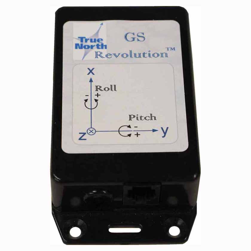
An electronic compass like the Revolution is able to sense both direction and pitch and roll. Its advantage over GPS is that it doesn’t have to be moving to determine azimuth. Also, it doesn’t require communication with external references like cell towers or satellites to achieve a high level of accuracy. It is rugged, requires very little power and has no moving parts. We have weatherproof enclosures if the application requires them.
Receive A Free Quote